Lake Titicaca / Peru Things to do
What are the most worthwhile things to do in Lake Titicaca on a first visit?
The short answer
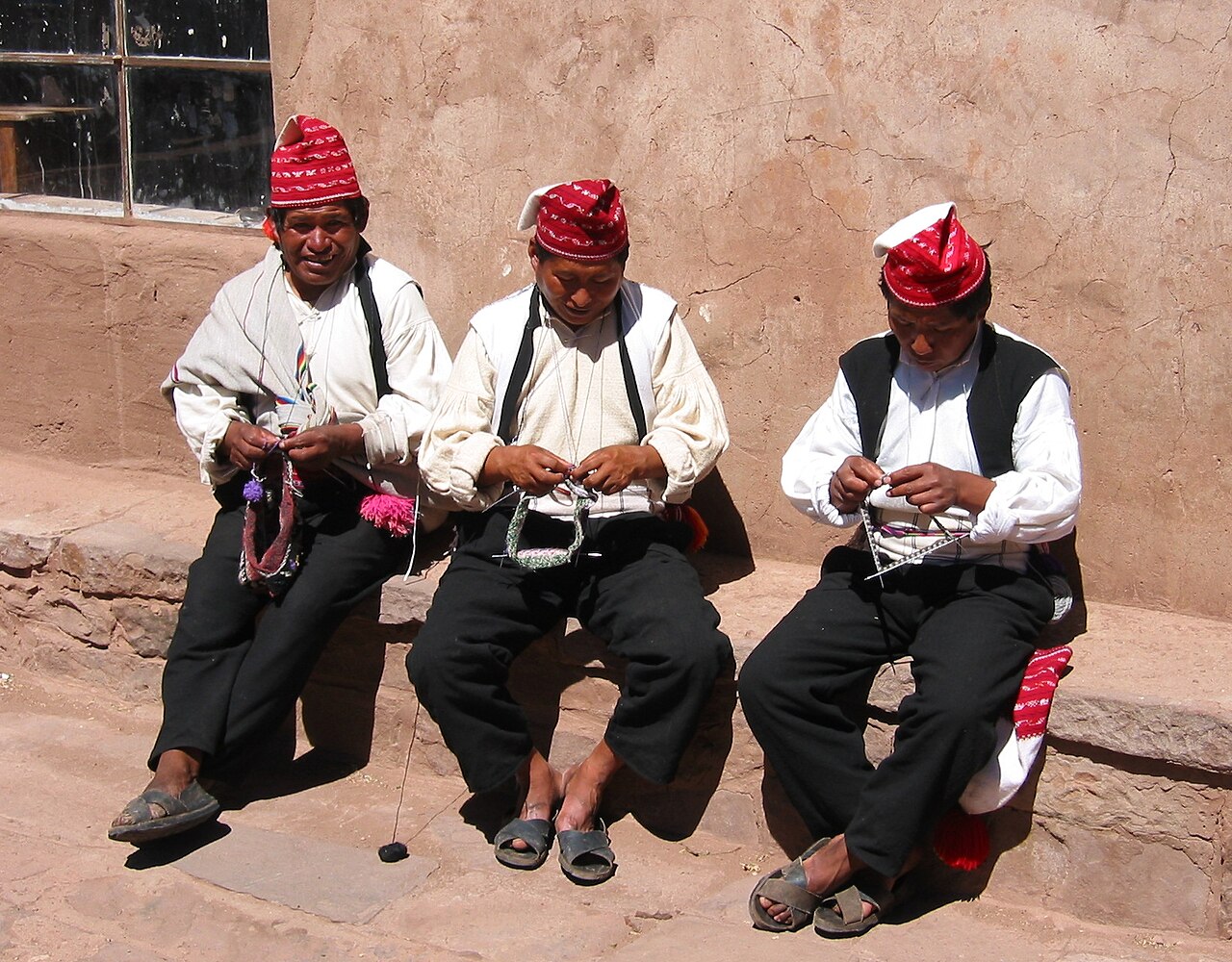
Go to Taquile and look at what people are wearing — UNESCO inscribed Taquile and its textile art on the Representative List in 2008, as element No. 00166, after proclaiming it in 2005.
The answer, with local context
Taquile is an island in Lake Titicaca on the Peruvian High Andean Plateau, and its textiles are the inscribed element rather than its scenery. UNESCO describes fabrics knitted or woven on pre-Hispanic four-stake ground looms, and singles out 2 garments: the chullo, a knitted hat with an earflap, and a wide woven calendar waistband displaying annual cycles tied to ritual and agricultural activities. The tradition is linked to the Inca, Pukara and Colla civilizations, and the island remained relatively isolated from the mainland until the 1950s — which is why a living textile practice of that age survived into the period when it could be documented.
The lake around it is a Ramsar wetland of international importance, and the designation is what explains the reed islands. The 1996 Ramsar Information Sheet for the Peruvian sector describes totora, Scirpus californicus ssp. tatora, as the dominant emergent vegetation around much of the lake's edge, growing to about 7 m (23 ft) with an optimal water depth of 2.5 to 4.5 m, and records that the totoral makes up about 80 percent of the Reserva Nacional del Titicaca. About 1,700 Uros-Chulluni live in the area, roughly 500 of them within the reserve. Those are the numbers behind the floating islands.
Wildlife is the third reason to be on the water rather than beside it. The sheet records 51 bird species confirmed, with at least 60 estimated — 35 resident and 16 migratory — alongside about 12 fish species, 15 amphibians, 8 mammals and 1 reptile, plus around 10 macrophyte species and 48 phytoplankton species. For a lake of 460,000 hectares on the Peruvian side with a maximum depth of 281 m (922 ft), that is a short list, and the endemism rather than the abundance is the point.
Picture the place
Reed beds run along much of the shoreline, standing to about 7 m where the water is 2.5 to 4.5 m deep, which is why the edge of the lake is a wall of vegetation rather than a beach. Behind it the altiplano runs flat to the horizon at roughly 3,810 m (12,500 ft).
The easily missed detail
The reeds are a resource under pressure, not a backdrop. The Ramsar sheet names indiscriminate totora harvesting among the site's threats, and records that during the 1983 drought about 600,000 kg were being extracted daily. It also lists burning of dry totora, bird poaching and egg collection, eutrophication of Puno Bay across about 16 km² with dense Lemna gibba growth linked to sewage, industrial and mining effluents reaching the lake from Juliaca via the Coata River, and salinization from old petroleum well seepage near Pirín. Knowing that changes what a reed-island visit means: the material is harvested, the harvest has a documented history of overuse, and the bay nearest Puno city is the most degraded water on the Peruvian side.
A practical rhythm
- Taquile — The textiles are the inscribed element; the chullo and the calendar waistband are what to look at, both made on four-stake ground looms.
- The reed islands — Totora covers about 80 percent of the Reserva Nacional del Titicaca and supports roughly 500 Uros-Chulluni living inside the reserve.
- On the water — 51 bird species are confirmed for the Peruvian sector, 35 resident and 16 migratory.
What could complicate the plan
Every one of these is a boat trip at roughly 3,810 m (12,500 ft), and the CDC's framing is worth carrying onto the water: acclimatization to moderate hypoxia is achievable up to about 5,200 m (17,000 ft) but takes time, and symptoms that appear more than 3 days after arrival without any further ascent should not be put down to acute mountain sickness. The State Department lists Puno among Peru's high-altitude cities, sets the country at Level 2, "Exercise increased caution," and requires a passport valid 6 months from the date of entry with at least 1 blank visa page. On the lake, drought and flood cycles change the extent of the totoral from year to year, which alters which channels and islands are reachable, and the Puno Bay eutrophication across about 16 km² is immediately adjacent to the main embarkation point.
What to do next
The Lake Titicaca when-to-visit question in this group sets out the February Candelaria festivity in Puno; the food question covers the FAO-designated Andean agricultural system that supplies the lakeshore.
Sources
- UNESCO Intangible Cultural Heritage, Taquile and its textile art — inscription and proclamation years, element number, four-stake ground looms, chullo and calendar waistband, linked civilizations, isolation until the 1950s
- Ramsar Sites Information Service, Lake Titicaca (Peruvian sector) Ramsar Information Sheet, dated 2 December 1996 — totora species, height and optimal depth, 80 percent share of the Reserva Nacional, Uros-Chulluni population, species counts, lake area and depth, named threats including the 1983 harvest figure and Puno Bay eutrophication
- US Department of State, Peru country information — Puno listed among high-altitude cities, advisory level, passport and blank-page requirements
- US Centers for Disease Control and Prevention, CDC Yellow Book 2026, High-Altitude Travel and Altitude Illness — upper limit of achievable acclimatization, 3-day rule on attributing symptoms