Madeira / Portugal Things to do
What are the most worthwhile things to do in Madeira on a first visit?
The short answer
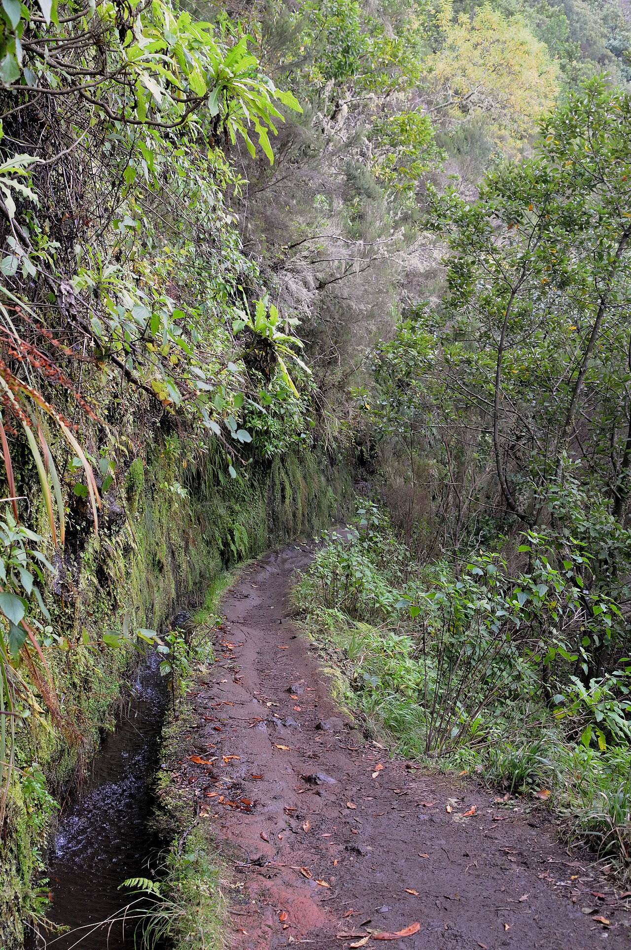
Walk the levadas into the UNESCO laurel forest — the Laurisilva of Madeira covers about 15,000 ha inside the 27,000 ha Madeira Natural Park, was inscribed in 1999 under criteria (ix) and (x), and roughly 90 percent of it has never been felled.
The answer, with local context
This is the largest surviving area of primary laurisilva anywhere, a forest type that now persists only in Madeira, the Azores and the Canary Islands. UNESCO's citation counts at least 76 vascular plant species endemic to Madeira, more than 500 endemic invertebrate species and 2 endemic birds — the Madeira laurel pigeon and the Madeiran firecrest — plus 13 liverwort and 20 moss species considered threatened at a European scale. The named trees are the ones you walk under: barbusano, laurel, til and vinhático.
The island's walking network is formally numbered and charged for. The official trail list runs to 42 marked routes — 39 on Madeira across Santana, Ribeira Brava, Câmara de Lobos, Funchal, Machico, Calheta, Porto Moniz, São Vicente and Santa Cruz, plus 3 on Porto Santo. PR 9, the Levada do Caldeirão Verde, is the benchmark walk: 8.7 km one way from the Queimadas Forest Park, about 6 hours 30 minutes, graded moderate, running between 872 m and 1,020 m and passing through 4 tunnels cut into the rock.
Those tunnels are the reason the walk needs preparation rather than just boots. A levada is a water channel, not a path built for walking, and PR 9 follows one along a cliff face for most of its length — which is also why the IUCN assessment lists levada and trail maintenance as a recognised pressure on the property.
Picture the place
A levada carries water, so its path follows the contour rather than the slope: the walking is near-level for most of its length, and the demanding part is the exposure on the open side and the unlit stretches driven straight through the rock.
The easily missed detail
Trail access is charged, and the official figures do not agree with each other. Madeira's regional tourism board publishes a tariff sheet showing €3.00 against every one of the 42 listed trails, while its own PR 9 page states €4.50 for visitors over 12, free for those aged 12 or under, paid through the SIMplifica portal, with parking at €2.00 per hour. Expect a small per-trail charge paid online before you walk, and check the amount on the day rather than relying on either figure. The same PR 9 page also prints an altitude of 2,200 m for Caldeirão do Inferno against its own stated maximum of 1,020 m, which is plainly an error.
A practical rhythm
- Before you go — Pay the trail charge through the SIMplifica portal; the under-13 exemption is stated on the trail page.
- On the trail — Budget the full 6 hours 30 minutes for PR 9 and carry light for 4 tunnels.
- Beyond the forest — The 3 Porto Santo routes, Vereda do Pico Branco e Terra Chã and the two Pico do Castelo walks, sit on a separate island.
What could complicate the plan
Trail closures are routine on this property: the IUCN assessment rates forest fires, invasive plants and rising temperatures as High Threats, and landslides as a current, if low-rated, threat on a terrain of cliff-side channels. Crossing to the 3 Porto Santo trails means a separate sea or air connection. PR 9 is graded moderate but runs 8.7 km one way, so the round trip is 17.4 km and the posted 6 hours 30 minutes leaves little daylight margin in winter. Visitors traveling with children should note the trail-charge exemption is set at age 12 and under, so a 13-year-old pays the adult rate.
What to do next
Read the Madeira when-to-visit answer for Funchal's month-by-month rainfall and wet-day counts, and the food answer for the regional wine statute and what it permits.
Sources
- UNESCO World Heritage Centre, Laurisilva of Madeira — criteria, property and park areas, share of primary forest, endemic species counts, named trees and birds
- Direção Regional do Turismo da Madeira (visitmadeira), official trail list and PR 9 page — 42 numbered trails, charges, PR 9 distance, duration, grade, altitudes and tunnels
- IUCN World Heritage Outlook, Laurisilva of Madeira — threat ratings including fire, invasive species, landslides and trail maintenance
- US Department of State, Portugal country information — passport and registration requirements