Indonesia country guide When to visit
When is the best time to visit Indonesia for Bali?
The short answer
May through September — the climate normals for Denpasar/Ngurah Rai give July just 27.6 millimeters of rain (1.1 inches) and August 36.4 millimeters (1.4 inches), against 350.7 millimeters (13.8 inches) in January.
The answer, with local context
Indonesia spans more than 3,000 miles of ocean along the equator, and its weather is monsoonal rather than seasonal in the temperate sense. Temperature barely moves anywhere in the archipelago; rainfall moves enormously. That means the planning question nationally is not "which month is warm" but "which monsoon is over which island," and the answer differs between Sumatra, Java, Bali, Sulawesi and Papua.
Bali's own figures make the point precisely. Denpasar's monthly mean temperature ranges only from 79°F (26.3°C) in August to 83°F (28.2°C) in November — a spread of under four degrees across the entire year. Rainfall ranges from 27.6 millimeters in July to 350.7 millimeters in January, a factor of nearly thirteen. December adds 327.4 millimeters (12.9 inches), February 289.8 (11.4 inches), March 231.1 (9.1 inches). April drops sharply to 107.4 millimeters (4.2 inches), May to 94.7, June to 67.9, and the dry trough holds through September's 59.4 millimeters before November's 131.2 millimeters signals the turn.
That gives a clear shape: April to October for dry weather with the driest core in July and August, and November to March for the wet monsoon. The temperature is effectively a constant, so the entire decision rests on rain and on one fixed date in the Balinese calendar.
Picture the place
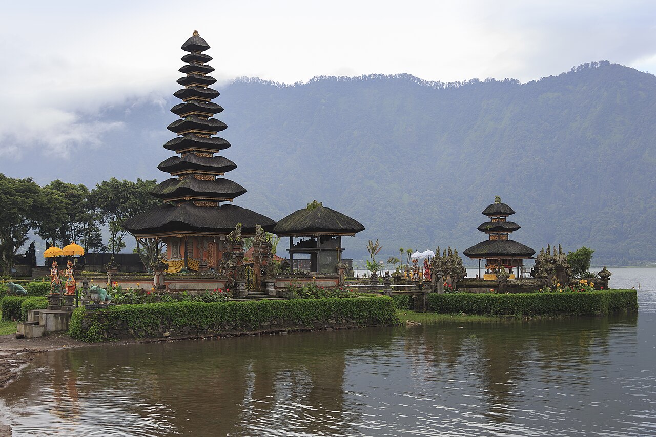
In August the terraced rice fields of the island's volcanic interior are worked under consistently dry skies, with the irrigation channels running rather than flooding, and the ridge lines above Bedugul hold clear. In January the same slopes are under nearly fourteen inches of rain across the month, and the afternoons close in.
The easily missed detail
Bali's defining UNESCO designation is agricultural, not architectural. The Cultural Landscape of Bali Province — the subak irrigation system as a manifestation of the Tri Hita Karana philosophy — covers 19,519.90 hectares of inscribed property with buffer zones of a further 1,454.80 hectares, across five component sites: the supreme water temple of Pura Ulun Danu Batur with Lake Batur, the subak landscape of the Pakerisan watershed, the subak landscape of Catur Angga Batukaru, and the royal water temple of Pura Taman Ayun. ICOMOS recommended inscription under criteria (iii), (v) and (vi) in March 2012. Tri Hita Karana translates as the three causes of goodness, and the rituals that govern how water is shared between subaks are part of what is protected. Visiting the terraces in the dry season means seeing a working water system at its most legible.
The other fixed date is Nyepi, the Balinese day of silence, and it stops the island completely. For Nyepi in 2026, I Gusti Ngurah Rai International Airport suspended all regular commercial flights for 24 hours, from 6:00 a.m. on 19 March to 6:00 a.m. on 20 March, under NOTAM A0096 — 440 scheduled flights, 231 domestic and 209 international. The last international departure left at 1:30 a.m. on 19 March and the first domestic departure after the closure was at 7:00 a.m. on 20 March. Nyepi follows the Balinese lunar calendar rather than a fixed Gregorian date, so it moves year to year, and the airport closure moves with it.
A practical rhythm
- July and August — The driest weeks of the year, at 1.1 and 1.4 inches of rain. Best for the subak terraces, the volcanic interior and open-water days.
- April to June and September to October — Rain between 2.3 and 4.2 inches a month, temperatures unchanged, far fewer visitors than the July–August core.
- December to February — Twelve to fourteen inches of rain a month. Green, humid, and the months when inland roads and trails are at their worst.
What could complicate the plan
Every foreign tourist entering Bali must pay a tourist levy of IDR 150,000 per person, separate from the visa, payable online in advance or at designated points on arrival. A tourist visa is required for Indonesia, either as an electronic visa applied for online in advance at evisa.imigrasi.go.id — within 90 days of arrival, and requiring a valid passport, the departure date and a booked return flight — or as a visa on arrival purchased at the airport. An electronic arrival card must also be completed online or in the All Indonesia app within 72 hours of arrival; the service is free and the QR code must be saved. The passport must be valid on entry, undamaged and unaltered, with at least six months of validity beyond the planned arrival date and two blank pages. The US Department of State places Indonesia at Level 2 — Exercise increased caution, issued 7 July 2026.
What to do next
The Indonesia trip-planning question in this group works through visa timing, the arrival card and internal distances; the places-and-experiences question covers what else in the archipelago justifies the dry-season weeks.
Sources
- Japan Meteorological Agency, Tokyo Climate Center, climatological normals for Denpasar/Ngurah Rai — monthly temperature and precipitation normals
- ICOMOS evaluation for the Cultural Landscape of Bali Province, via UNESCO World Heritage Centre — component sites, inscribed and buffer-zone areas, recommended criteria, Tri Hita Karana
- UNESCO World Heritage Centre, States Parties statistics — Indonesia's 10 inscribed properties
- Antara News — Nyepi airport closure dates and times, NOTAM reference, flight counts
- US Department of State, Indonesia travel advisory and country information — advisory level and date, visa routes, passport rules, arrival card, Bali tourist levy