Lake Atitlan / Guatemala When to visit
When should I visit Lake Atitlan, Guatemala, for the best experience?
The short answer
November — the rains have just ended, the caldera rim is at its greenest, the lake is full and glassy at dawn, and the peak-season crowds and strong north winds have not yet arrived.
The answer, with local context
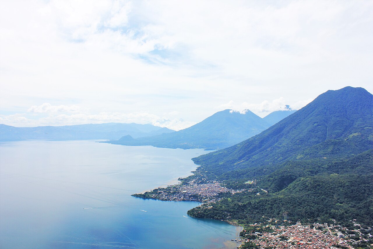
Lake Atitlán runs on the highland calendar — dry November to April, rainy May to October — but the lake sharpens the choice. Through the wet season the lake level climbs, and by November the water is high, the hillsides around the caldera are deep green from six months of rain, and the afternoons finally clear. Temperatures barely change all year at 5,125 feet (1,562 m): days in the mid-70s°F, nights in the 50s°F, with Panajachel averaging about 63°F (17°C) annually. What November changes is the view and the water — and at Atitlán those are the whole point.
The lake's daily rhythm governs everything you do here, in every month. Mornings are calm and the surface is glass; by late morning a wind rises called the Xocomil — Kaqchikel for "the wind that carried away sin" — which whitens the water, rocks the lanchas and can make afternoon crossings genuinely rough, with boat travel best avoided after about 3 p.m. November's Xocomil is the gentle version; December and January add the nortes, the cold north winds that can chop the lake for days. In November you still get dawn paddles, smooth crossings and the volcanoes — Atitlán (11,598 ft / 3,535 m), Tolimán (10,361 ft / 3,158 m) and San Pedro (9,908 ft / 3,020 m) — standing clear across the water at breakfast.
The geology under that view deserves a clear morning too. The lake fills a caldera blown open about 84,000 years ago by the Los Chocoyos eruption, an event so large its ash has been found from Florida to Ecuador; the lake that gathered in the crater covers 50 square miles (130 km²), drops to about 1,115 feet (340 m) — the deepest lake in Central America — and has no river outlet, draining only underground. November also lands between seasons socially: the Day of the Dead on November 1 brings the giant-kite traditions of the highlands within day-trip reach, while the Christmas and Easter peaks that crowd Panajachel are still weeks away.
Picture the place
At 6:30 a.m. in November a fishing cayuco moves across water so still that Volcán San Pedro is doubled in it, and by 11 the Xocomil arrives on schedule, stitching whitecaps across the blue as the morning boats hurry home.
The easily missed detail
The lake breathes with the seasons more than visitors expect: without an outlet, its level rises steadily through the rainy months and falls through the dry ones, and it can shift far faster — after the February 1976 earthquake fractured the lake bed, the level dropped about 6 feet (2 m) in a matter of weeks. Docks, shoreline paths and lakeside cafés sit at noticeably different heights above the water in November than in April.
A practical rhythm
- Lake mornings only — Schedule kayaking, swimming and every long lancha crossing before 11 a.m., before the Xocomil builds
- Sleep on the water in November — Base in a shore village (San Marcos, Santa Cruz, San Juan) now, when crossings are easy and evenings are quiet
- Volcano views at dawn — Take the Indian Nose sunrise hike early in your stay, while November skies are clearest, in case weather turns
What could complicate the plan
Early November can catch the tail of the rains — a leftover storm week is possible, especially in the season's first days. The All Saints' period (November 1–2) fills highland roads and hotels around the kite festivals at Sumpango and Santiago Sacatepéquez. From mid-December the nortes strengthen and the lake's afternoons grow rougher, and Panajachel's rates step up for the holidays.
What to do next
Book mid-to-late November, aim for a lakeshore village rather than a day trip, and put every water activity on the morning side of your days.
Sources
- Smithsonian Global Volcanism Program / U.S. Geological Survey — the Los Chocoyos caldera eruption about 84,000 years ago and Atitlán's three post-caldera volcanoes
- Lake Atitlán basin authorities (AMSCLAE) and limnological references — 1,562 m elevation, 130 km² surface, 340 m maximum depth, endorheic drainage
- Guatemalan linguistic and cultural references (Academia de Lenguas Mayas) — the Xocomil wind and its Kaqchikel meaning
- INGUAT (Guatemalan Tourism Institute) — highland dry season, November to April, and the lake's village network