Salar de Uyuni / Bolivia Things to do
What are the most worthwhile things to do in Salar de Uyuni on a first visit?
The short answer
Treat the salt flat as half the trip and the Los Lípez lagoons as the other half — Ramsar lists Los Lípez at 1,427,717 hectares (5,512 square miles), holding about 25 percent of the world's Andean flamingos and about 50 percent of the world's James's flamingos.
The answer, with local context
That wetland was designated on 27 June 1990, originally under the name Laguna Colorada and covering 51,318 hectares. On 13 July 2009 it was extended to its present 1,427,717 hectares, roughly 28 times the original area. Half of the Ramsar site is protected domestically as the National Andean Wildlife Reserve Eduardo Avaroa, which is its national legal designation — so the lagoons you reach from Uyuni carry 2 overlapping protections, and only one of them covers the whole area.
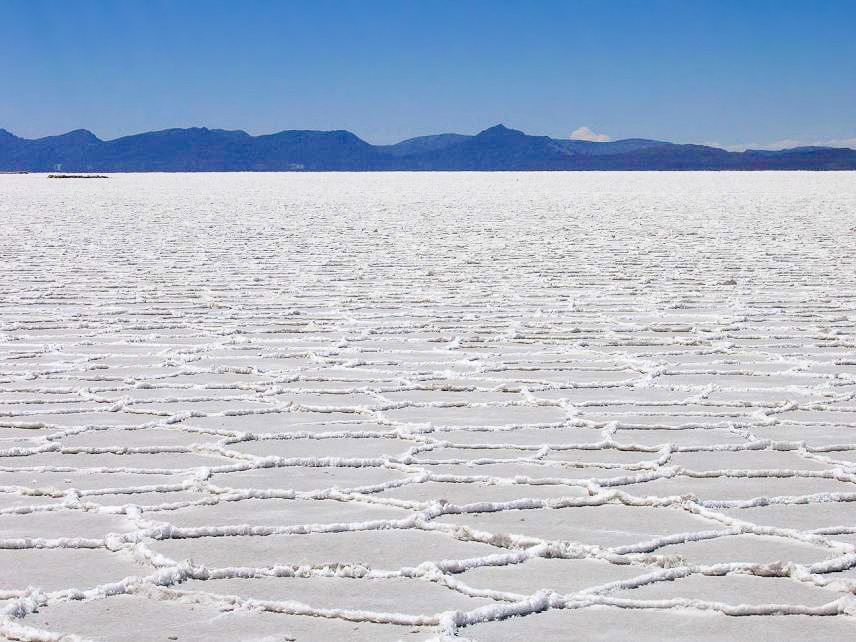
The salt flat itself is better documented by geologists than by tourism bodies. The US Geological Survey puts the Salar de Uyuni at about 9,000 km² (3,475 square miles) and reports brine lithium concentrations ranging from 80 to 1,500 parts per million, with the richest values of 300 to 700 ppm concentrated in an area of about 2,500 km² (965 square miles) in the east-central and southeastern part of the salar. That survey work dates from 1977 and 1978, and its figures are the classic reference rather than a current resource statement.
The current statement is a short one. USGS Mineral Commodity Summaries for February 2026 gives Bolivia measured and indicated lithium resources of 23 million tons against a world total of about 150 million tons, and reports brine-based lithium sources in various stages of development or exploration in Argentina and Bolivia. World lithium production, excluding the United States, was about 222,000 tons in 2024 and about 290,000 tons in 2025.
Picture the place
The 2 halves of the trip could hardly look less alike. The salar is a flat white crust the size of a small country, where the richest brine lies under roughly a quarter of the surface in its eastern and southeastern reaches. The Los Lípez lagoons behind it sit between 4,200 m and 6,000 m, shallow and colored, with flamingo flocks that between 2 species account for a quarter and a half of their global populations.
The easily missed detail
Uyuni is a staging post, not the destination. Ramsar names it as the main access point to Laguna Colorada and puts the distance at about 210 km, which is why the standard southern circuit is a multi-day drive rather than a day trip. The 1998 information sheet recorded 5 hotels offering about 150 beds in the area and an average of 800 foreign visitors a month — a snapshot of how thin the infrastructure was, and a reminder that the sheet's accommodation figures are 2 decades out of date even where its designation data is not.
A practical rhythm
- Salar day — The flat covers about 9,000 km², so distances across it are driving distances, not walking ones.
- Lagoon days — The 210 km to Laguna Colorada and an average site altitude above 4,200 m make this the part of the circuit that needs its own nights.
- Flamingo hours — The 2 species Ramsar names concentrate here in the shares it records, so the lagoons are the wildlife stop and the salt is not.
What could complicate the plan
Ramsar is explicit that tourism has already caused negative impacts on these lakes and names mining as another important threat, in a site it describes as the most visited protected area in Bolivia. Access runs through the Eduardo Avaroa reserve, which covers only half the Ramsar area, so protections and permissions are not uniform across the circuit. The USGS brine figures are survey results from 1977 and 1978 and should not be read as a description of present-day extraction, and the 23-million-ton resource figure in the February 2026 summary is a resource estimate, not production. Altitude governs everything else, and the lagoon nights are spent higher than the salt flat days. The CDC's Yellow Book is useful on what that does to sleep: periodic breathing becomes nearly universal above about 2,700 m (9,000 ft), and while the body can adapt to moderate hypoxia up to roughly 5,200 m (17,000 ft), it needs time to do it. On a circuit whose refuges sit above 4,200 m, broken sleep is the normal outcome rather than a sign something has gone wrong.
What to do next
The Salar de Uyuni when-to-visit answer in this group covers the wet season, the altitude acclimatization schedule and the entry rules, and the food answer deals with quinoa and singani.
Sources
- Ramsar Sites Information Service, Los Lípez (site no. 489) — designation on 27 June 1990 as Laguna Colorada, the 51,318 to 1,427,717 hectare extension of 13 July 2009, the 4,200 to 6,000 m altitude range, the Andean and James's flamingo population shares, the Eduardo Avaroa reserve covering half the site, Uyuni as access point and the 210 km distance, hotel and bed counts, monthly visitor average, tourism and mining threats
- US Geological Survey — the salar's approximate 9,000 km² area, brine lithium range of 80 to 1,500 ppm, the 300 to 700 ppm zone of about 2,500 km², the 1977 and 1978 report dates
- US Geological Survey, Mineral Commodity Summaries, February 2026 — Bolivia's 23 million tons of measured and indicated lithium resources, the 150 million ton world total, world production of about 222,000 tons in 2024 and 290,000 tons in 2025
- CDC Yellow Book 2026, High-Altitude Travel and Altitude Illness — periodic breathing above about 2,700 m and the roughly 5,200 m ceiling for adaptation to moderate hypoxia