Salar de Uyuni / Bolivia When to visit
When should I visit Salar de Uyuni, Bolivia, for the best experience?
The short answer
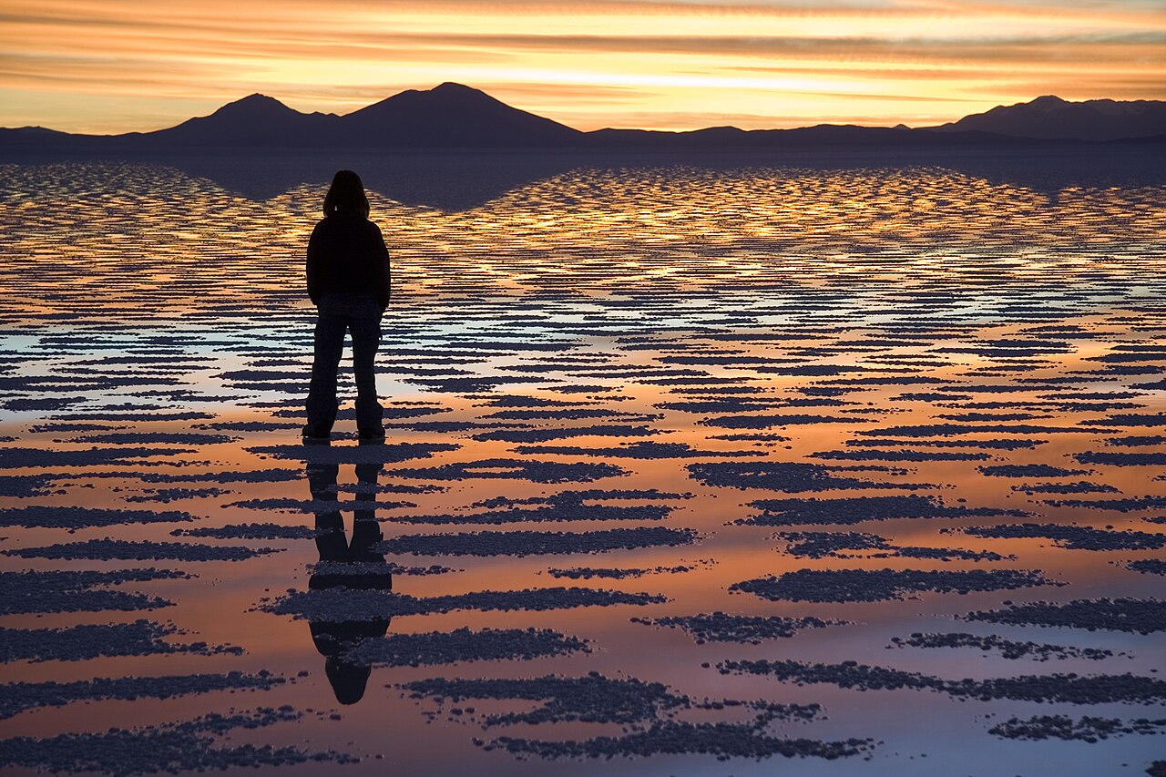
December to February, because that is the only wet season this landscape has — the Ramsar information sheet for the Los Lípez wetland south of the salt flat records a December-to-February wet season and the rest of the year as dry, in a basin that receives about 65 mm (2.6 inches) of rain a year.
The answer, with local context
Those are small numbers, and they are the whole reason the mirror effect is seasonal rather than permanent. The same sheet, dated 24 November 1998, describes conditions that explain why: intense solar radiation, strong winds, low atmospheric pressure, and a daily temperature range of roughly -25°C to +25°C (-13°F to 77°F). In the still water of the lagoons it records minimums of 0°C to 5°C and maximums reaching 22°C.
Height is the second variable. The sheet puts the lake at 4,232 m (13,885 ft) and the site's average altitude at 4,278 m (14,035 ft), and names Uyuni as the main access point to Laguna Colorada, about 210 km (130 miles) away. Ramsar's current entry for the site gives its altitude range as 4,200 m to 6,000 m, and the CDC notes that high-altitude cerebral edema is rare below 4,300 m (14,000 ft) — so the lagoon nights sit at the edge of where the serious syndromes start. These are not elevations you can land at and immediately start walking around.
The CDC's Yellow Book turns that height into a schedule. It grades a first night's sleeping altitude as low below 2,750 m, medium between 2,750 m and 3,400 m and high above 3,400 m, and reports that acute mountain sickness rates approach 50 percent among travelers who fly straight up past 3,400 m with no staged acclimatization. Symptoms typically appear 2 to 12 hours after arrival, often during or just after the first night, and clear within 12 to 48 hours provided you climb no further. Part of the reason is simply how little oxygen there is to breathe: at about 3,050 m, inspired oxygen is only 69 percent of the sea-level figure.
Picture the place
A swing of roughly 50 Celsius degrees in a single day is the defining physical fact of the altiplano. The sun at this altitude is strong enough to make midday feel like high summer and the air thin enough to give it all back after dark, which is why the wet-season months, when standing water moderates the surface, are also the months when the flat photographs as a mirror.
The easily missed detail
Visitor numbers run opposite to the water. Ramsar records tourism in the Los Lípez area as a year-round activity that peaks in August and September — the dry, cold months — so the season that gives you the mirror is not the season that gives you company, and the season with the most visitors is the one with no reflection at all.
A practical rhythm
- December to February — The wet months, and the only ones the Ramsar sheet classes as wet.
- August and September — Ramsar's stated peak for visitors, and the driest, coldest stretch of the year.
- First 48 hours — Above 3,000 m the CDC caps a night-on-night sleeping gain at 500 m (1,650 ft) and asks for an added rest night per 1,000 m (3,300 ft) climbed, so the front of the trip belongs to acclimatizing rather than to the salt.
What could complicate the plan
Entry is straightforward but conditional, and the clearest reachable statement of the rules is written for British passport holders rather than American ones. The UK Foreign, Commonwealth and Development Office's Bolivia guidance, publicly updated on 22 September 2026, says a passport should expire at least 6 months after the arrival date and carry at least 2 blank pages, and that visa-free tourist stays run to 90 days in any one-year period even though border officials usually issue 30-day stamps. A yellow fever vaccination certificate is required when arriving from a country listed as a transmission risk. The same page notes that the Bolivian authorities set and enforce these requirements, so a US traveler should confirm the current terms with a Bolivian consulate rather than assume the British conditions apply unchanged. Supply is the less obvious constraint: FAO's GIEWS country brief for Bolivia, reference date 9 September 2026, records diesel shortages slowing the winter cereal harvest, and a long 4-wheel-drive circuit across the altiplano is a diesel operation. Ramsar also records tourism itself as having caused negative impacts on these lakes, with mining named as another important threat, in what it calls Bolivia's most visited protected area at around 70,000 tourists a year.
What to do next
The Salar de Uyuni things-to-do answer in this group covers the Los Lípez lagoons and the flamingo populations in detail, and the food answer handles quinoa, singani and eating at altitude.
Sources
- Ramsar Sites Information Service, Los Lípez (site no. 489) — the December-to-February wet season, 65 mm annual precipitation, the daily temperature range, lagoon water temperatures, the 4,232 m and 4,278 m altitudes, the 210 km distance from Uyuni, the August-September visitor peak, the 70,000 annual visitors, tourism and mining as threats
- CDC Yellow Book 2026, High-Altitude Travel and Altitude Illness — the 500 m per night ascent rule above 3,000 m, the extra night per 1,000 m, the 50 percent AMS figure above 3,400 m, onset and resolution windows, the 69 percent inspired-oxygen figure
- UK Foreign, Commonwealth and Development Office — passport validity and blank pages, the 90-day visa-free allowance and 30-day stamping practice, the yellow fever certificate condition, the update date
- FAO GIEWS country brief, Plurinational State of Bolivia — reference date 9 September 2026 and the recorded diesel shortages