Victoria Falls / Zimbabwe When to visit
When should I visit Victoria Falls, Zimbabwe, for the best experience?
The short answer
April and May, when the Zambezi's flow over the Falls reaches its annual peak — the Zimbabwe Parks and Wildlife Management Authority records peak flows between March and May, and charges a USD 50 daily conservation fee at the Rainforest Ordinary Gate for international day visitors at any water level.
The answer, with local context
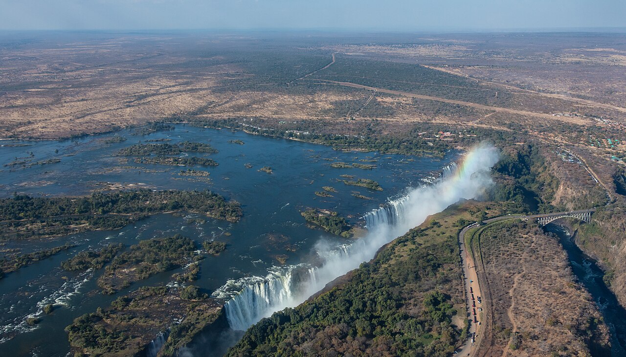
The river, not the calendar, decides what you see here. ZimParks puts average Zambezi flow above 1,000 cubic meters per second, with the peak falling between March and May and the low point in October and November at roughly 262 cubic meters per second — about 9,250 cubic feet per second, a quarter of the average. The same 5,604-foot rock lip delivers two completely different spectacles depending on which of those months you pick.
Rain and flow are out of step, and that is the whole trick of timing a trip. Mean annual rainfall at Victoria Falls is 657 mm, roughly 26 inches, and the bulk of it falls between December and February. The water those storms dump across the upper Zambezi catchment reaches the gorge weeks later, so the Falls are at their loudest once local skies have largely cleared.
Heat runs on its own schedule again. Mean monthly maximum temperatures peak in October and November, usually above 77°F (25°C), while winter mean minimums can drop below 43°F (6°C) — cold enough that ZimParks advises warm clothing for April through August, and cool clothing with sunhats and sunscreen from September to March.
Fees are charged per day rather than per visit, so two mornings at the Falls costs an international visitor USD 100. Regional SADC day visitors pay USD 30 and residents USD 7.
Picture the place
In April the spray rises high enough to water a standing forest: ferns, palms, liana vines and mahogany grow in a strip kept permanently damp by the river's own weather. By late October that same strip dries out, the mist column shrinks, and the basalt walls of the gorge come into view through gaps the water had hidden.
The easily missed detail
The rainforest everyone walks is tiny. The Falls and Rain Forest management zone covers just 0.45 square kilometers inside a park whose gazetted area is 23.4 square kilometers, and access to it is fenced and tightly controlled. UNESCO inscribed the property as Mosi-oa-Tunya / Victoria Falls in 1989 under criteria (vii) and (viii) — for exceptional natural beauty and for the geological record of the gorges, which means the dry-season view of bare rock is part of what was listed, not a disappointing version of it.
A practical rhythm
- High water, March to May — Expect to be soaked and to see less of the rock face; the volume is the point, and a waterproof layer matters more than a long lens.
- Shoulder, June to August — Flow is dropping and nights get genuinely cold, with mean minimums capable of falling under 43°F (6°C).
- Low water, October and November — Flow bottoms out near 262 cubic meters per second and daytime maximums peak; the gorges, islands and the Falls' lip are at their most exposed.
What could complicate the plan
The daily fee structure penalizes repeat entries, and there are four separate park gates — Zambezi Drive, Chamabonda, Km 16 and the Rainforest — so arriving at the wrong one costs time. The US Centers for Disease Control and Prevention lists Zimbabwe among destinations affected by East African Sleeping Sickness at Level 1, Practice Usual Precautions, alongside a Level 1 Global Measles notice. ZimParks warns about slippery rock and the cliff edge inside the Rainforest, and notes baboons, warthogs and monkeys as the animals you will actually meet.
What to do next
The things-to-do question in this group covers what the fee buys beyond the viewpoints, including the gorge zones and the river above the lip.
Sources
- Zimbabwe Parks and Wildlife Management Authority, Zambezi and Victoria Falls General Management Plan — flow figures, rainfall, temperature, management zones
- Zimbabwe Parks and Wildlife Management Authority, 2023 rates and park page — conservation fees, gates, clothing advice, park area
- UNESCO World Heritage Centre, Mosi-oa-Tunya / Victoria Falls — inscription year and criteria
- US Centers for Disease Control and Prevention, travel health notices — notice levels for Zimbabwe