Zambia country guide When to visit
When is the best time to visit Zambia for Victoria Falls?
The short answer
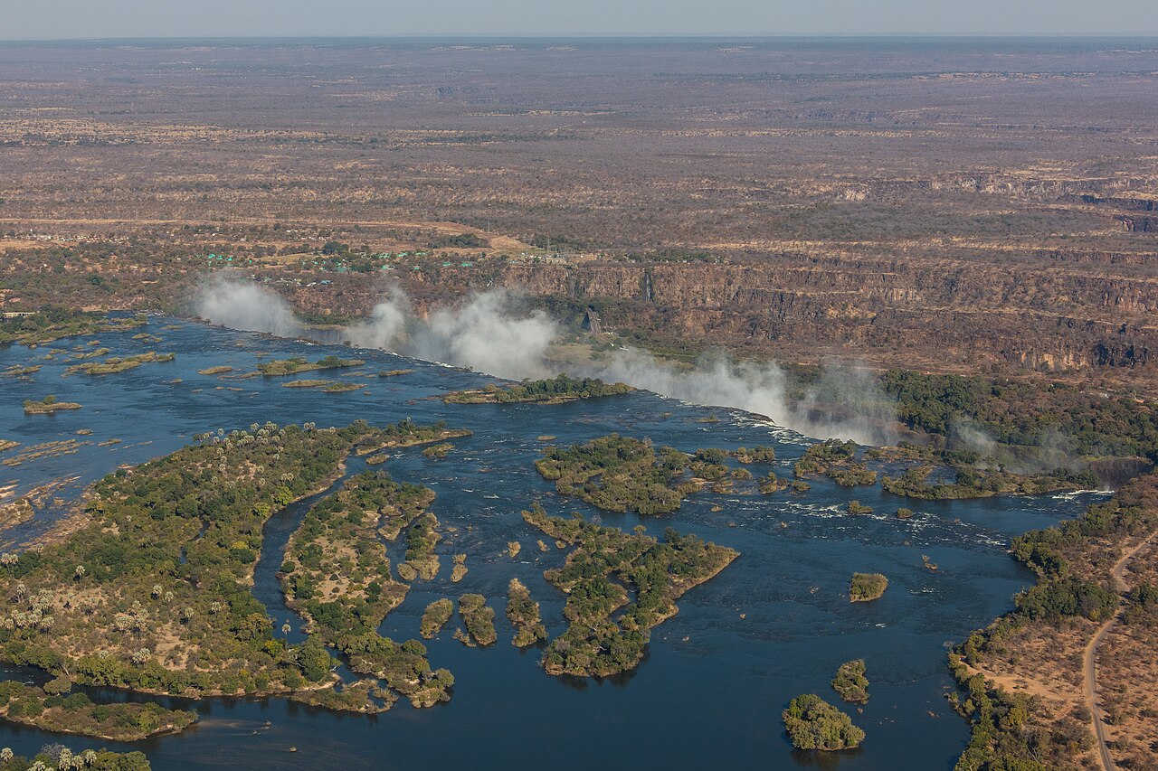
There are effectively 2 Victoria Falls, and the switch happens in early September — IUCN records that Zambezi flows below 400 cubic meters per second are usual from early September to mid-December, so that window gives you exposed basalt and the Zambian-side rock walks, while the high-water months give a curtain up to 1,708 meters wide.
The answer, with local context
The hydrology is published and it is the whole answer. At peak flow the falls run 1,708 meters wide and carry up to 500 million liters per minute, throwing a spray plume about 500 meters into the air that is visible from 20 kilometers away. In the low-flow months the same lip drops below 400 cubic meters per second — for scale, IUCN notes that the Zambian hydroelectric station needs 175 cubic meters per second to run at full capacity. Nothing about the falls is constant across a year.
UNESCO inscribed Mosi-oa-Tunya / Victoria Falls in 1989 as a transboundary property shared by Zambia and Zimbabwe, under criteria (vii) and (viii). IUCN finalized its conservation outlook as "Good with some concerns" on 11 October 2025.
Upstream, the flood pulse that fills the falls is visible on a grand scale in Zambia's Western Province. The Barotse floodplain, on Zambia's World Heritage Tentative List since 10 March 2009, runs about 230 kilometers north to south and over 30 kilometers wide along most of its length, widening to roughly 50 kilometers near Mongu. Its main plain covers about 5,500 square kilometers, and the maximum flooded area reaches about 10,750 square kilometers. The northern highlands that feed it receive about 1,400 millimeters of rain a year, and at the lowest water level in November only about 537 square kilometers of lagoons, swamps and channels remain.
Picture the place
Below the lip, 8 gorges cut through the basalt. The whole gorge system runs about 110 kilometers, of which 16 kilometers lie inside the inscribed property. In the spray zone a fragile riverine rainforest survives entirely on the humidity the plume delivers — which means that in a low-flow year the forest is as affected as the view.
The easily missed detail
Low water is not a lesser visit on the Zambian side; it is a different one. Because the flow drops enough to expose rock and reduce the spray, September to mid-December is when the Zambian edge of the lip becomes walkable and the gorges below are visible rather than hidden in mist. The trade-off is published too: IUCN rates reduced water flow from hydropower abstraction and climate-driven drought a High threat, naming the 2019/2020 drought, and warns that potential upstream abstraction for irrigation could cut dry-season flows by a further 5% to 10%.
A practical rhythm
- High water — The full 1,708-meter curtain and a plume rising about 500 meters, with the rainforest in the spray at its wettest.
- Low water — Early September to mid-December, when flows under 400 cubic meters per second expose the basalt lip and the gorge walls.
- Upstream — February and March, when the Zambezi floods the Barotse plain, as recorded for the Ramsar site covering those floodplains.
What could complicate the plan
A proposed dam, the Batoka Gorge Hydro Electric Scheme, sits outside the property but would flood part of the gorge system, and IUCN rates it a High threat. Urban growth in Livingstone and in Victoria Falls town is another, as is tourism pressure itself — IUCN specifically lists helicopter and microlight noise, river cruises and infrastructure built close to the falls. Invasive Lantana camara and water hyacinth are also High-rated. On the health side, the State Department recommends malaria prophylaxis for all travelers to Zambia, even on short stays, and advises insecticide-treated nets. Zambia requires no visa of US passport holders, but a passport needs at least 6 months of validity and 3 blank pages per entry, and proof of yellow fever vaccination is required only of travelers arriving from a country where the disease is endemic.
What to do next
The Zambia places-and-experiences answer covers the Barotse plain and the Luangwa valley as destinations rather than catchment, and the trip-planning answer handles entry, health and internal travel.
Sources
- IUCN World Heritage Outlook, Mosi-oa-Tunya / Victoria Falls — inscription year, criteria, crest width, peak discharge, low-flow months and threshold, hydro station requirement, spray plume height and visibility, gorge count and lengths, spray-zone rainforest, conservation outlook rating and date, threat ratings
- UNESCO World Heritage Centre, Tentative List 5428, Barotse Cultural Landscape — submission date, floodplain dimensions, plain and flooded areas, highland rainfall, November low-water extent
- Ramsar Sites Information Service, Zambezi Floodplains — February-to-March flood timing
- US Department of State, Zambia country information — visa, passport validity and blank pages, yellow fever condition, malaria guidance