Antananarivo / Madagascar When to visit
When should I visit Antananarivo, Madagascar, for the best experience?
The short answer
May through October is the most reliable period for exploring Antananarivo on foot, with July averaging just 0.26 inches (6.5 mm) of rainfall compared with 12.8 inches (325.5 mm) in January.
The answer, with local context
Madagascar's capital lies in the central highlands, where elevation moderates the tropical climate. The World Meteorological Organization publishes 1981–2010 observations supplied by Madagascar's national meteorological service. January averages a daytime high of 80°F (26.4°C) and a low of 63°F (17.3°C), while July averages a high of 69°F (20.5°C) and a low of 51°F (10.5°C).
Rainfall changes more dramatically than temperature. January receives 325.5 mm (12.8 inches) over an average of 19 rainy days. February receives 254.5 mm (10 inches) over 18 days. By May, rainfall falls to 16 mm (0.63 inches), and June receives just 4 mm (0.16 inches). September remains dry, averaging 9.4 mm (0.37 inches).
The Japanese Meteorological Agency's records for Antananarivo-Ivato place the observation station at 1,279 meters (4,196 feet) above sea level. That altitude helps explain why the capital's winters are noticeably cooler than Madagascar's tropical coast. September's average daytime high is 75°F (23.7°C), while October reaches 78°F (25.7°C).
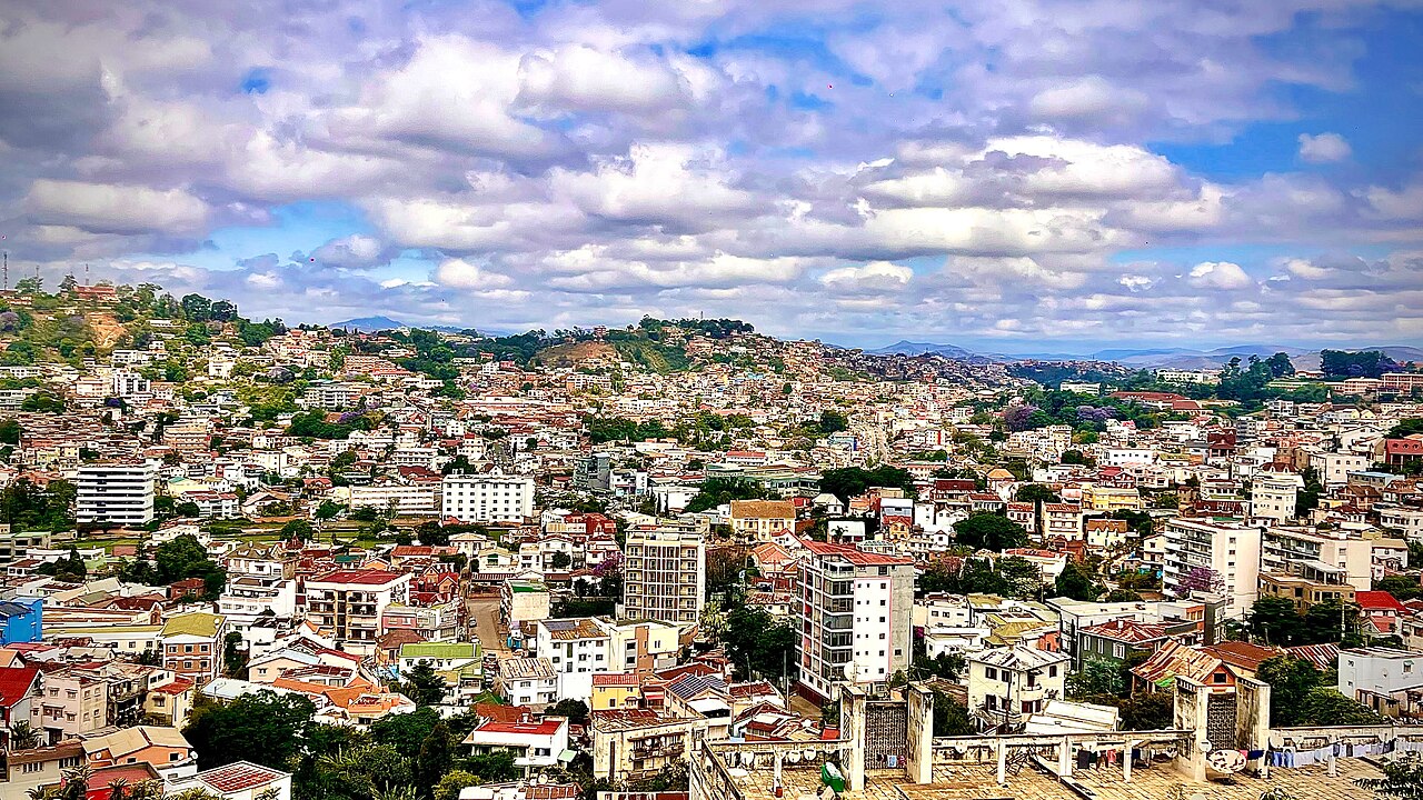
The distinction matters because Antananarivo is built across hills. Visits to the Upper Town, including the royal complex on Analamanga Hill, involve slopes, stairways, and exposed streets. During the wettest months, heavy rainfall can also aggravate urban flooding and landslide hazards in parts of the highlands.
Picture the place
Antananarivo spreads across ridges and valleys, with tightly packed houses climbing steep slopes. The Rova's stone palace rises above the Upper Town, while lower districts contain broader avenues and commercial squares.
The easily missed detail
September combines relatively mild temperatures with some of the year's lowest rainfall. The WMO records an average high of 75°F (23.7°C), only three rain days, and less than half an inch of precipitation. It offers a different walking experience from January, when average rainfall exceeds twelve inches.
A practical rhythm
Morning — Upper Town: Walk the historic streets around Andohalo and the royal hill.
Midday — Rova: Explore the restored royal complex and its historical collections.
Afternoon — Lower Town: Visit Analakely and the Avenue de l'Indépendance.
What could complicate the plan
Madagascar's rainy season generally runs from November through April, and tropical cyclones can affect the island during that period. The U.S. State Department's advisory issued December 5, 2025 places Madagascar at Level 2: Exercise Increased Caution, citing crime, unrest, and health concerns. It also identifies demonstrations in Antananarivo and warns that roads and pedestrian facilities can be hazardous.
What to do next
explores Antananarivo's royal architecture and historic districts. introduces the Malagasy foods found in the capital's markets and restaurants.
Sources
- World Meteorological Organization, Antananarivo Climate — monthly minimum and maximum temperatures, rainfall, and rain days.
- Japan Meteorological Agency, Antananarivo-Ivato Climate Normals — station elevation and monthly climate observations.
- Regional Tourism Office of Antananarivo, Rova — Upper Town geography and royal hill.
- U.S. Department of State, Madagascar Travel Advisory — advisory and seasonal hazards.