Atacama Desert / Chile Things to do
What are the most worthwhile things to do in Atacama Desert on a first visit?
The short answer
Pair one archaeological site with one salt-flat sector and one night sky — the Pucará de Quitor, a 12th-century Atacameño hill settlement 2 kilometers north of San Pedro de Atacama, is the shortest trip and the most legible.
The answer, with local context
Quitor is built into a slope that rises about 262 feet (80 m) from its base, and Chile's Ministry of Cultures describes it as a construction of enclosures and terraces with a panoramic view over the valley, its subdivisions probably serving as dwellings, animal shelters, storerooms and defensive enclosures, linked by labyrinthine corridors with ramps and stairs. After the 2019 rains the Secretaría Técnica of the Consejo de Monumentos Nacionales funded emergency works costing 120 million pesos, completed by a consultancy in about 2 months; the gullies cut by the water were turned into channels to divert future rain, and a weather station was installed to monitor rainfall, wind and radiation. The Council also approved a guide booklet, guard training and work toward a site management plan, with the Quitor community involved throughout.
The salt-flat half of the trip is the Reserva Nacional Los Flamencos, which Chile's tourism board describes as protecting more than 73,000 hectares of high-Andean ecosystems and as home to all 3 flamingo species that live in Chile, along with vicuñas and foxes. Laguna Chaxa is the sector most visitors see; others sit up on the altiplano along Ruta 23. Because each sector sets its own access and schedule, the realistic plan is one sector per half-day rather than a loop.
The third thing is the sky, and the Atacama's reputation here is a measured one rather than a marketing one. The European Southern Observatory reports that about 90 percent of nights at Paranal are usable for observing, and that photometric nights — the cleanest grade, good enough for precise brightness measurement — make up about 30 percent of the total. Those are the figures that explain why the observatories chose this ground.
Picture the place
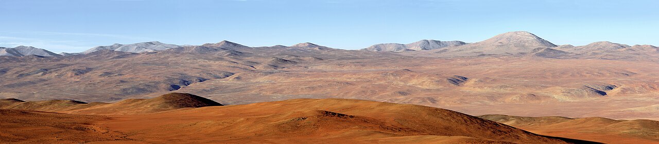
Quitor reads as a stack rather than a plan: terraces and small walled rooms climbing a slope that gains 262 feet (80 m), with corridors narrow enough to turn the ascent into a series of switchbacks, and the valley floor and its irrigated green strip laid out flat below.
The easily missed detail
The weather station now standing at Quitor is the useful tell. It was installed as part of a risk-management programme after a single storm damaged a site that had survived since the 12th century — which is also a reminder that the archaeology here is earthen and soluble. The Council's approved programme included guard training and maintenance of the works, so what you walk on is actively managed ground, not a ruin left to weather.
A practical rhythm
- Short morning — Quitor is 2 kilometers from San Pedro, so it fits before the heat and before the day's longer excursion.
- Afternoon — One Los Flamencos sector. Laguna Chaxa for the flamingos; the Ruta 23 altiplano lagoons if you want elevation.
- After dark — The observatory statistics explain the draw: roughly 90 percent of nights here are usable for astronomy, about 30 percent of them photometric.
What could complicate the plan
Every sector of Los Flamencos is booked separately on its own platform, and none of them permits overnight stays or camping, so a first visit is a series of day returns to town rather than a progressive route. Quitor has been closed to visitors before — the community shut it on 28 February 2019 after storm damage, leaving only the lookout accessible — and an earthen site on a steep slope stays vulnerable to the next altiplanic rain. The altiplano sectors also put you well above the town, and the CDC notes that periodic breathing becomes nearly universal above about 9,000 feet (2,700 m), so a bad first night is common rather than unlucky.
What to do next
The seasonal question in this chapter gives the humidity, clear-sky and rainfall figures behind these choices, and the food question covers what the desert's oases actually grow.
Sources
- Chile, Ministry of Cultures, Arts and Heritage, and Consejo de Monumentos Nacionales — Quitor's 12th-century date, distance from San Pedro, slope height, construction, 2019 emergency works and cost, weather station, management programme
- Chile, national tourism board, Reserva Nacional Los Flamencos — hectares protected, 3 flamingo species, Laguna Chaxa, Ruta 23 lagoons, no camping
- European Southern Observatory, Paranal site information — share of usable nights, share of photometric nights
- CDC Yellow Book 2026, High-Altitude Travel and Altitude Illness — periodic breathing threshold