Brittany / France Things to do
What are the most worthwhile things to do in Brittany on a first visit?
The short answer
Walk Saint-Malo's ramparts at a changing tide, stand among Carnac's 3,000 stones, follow the pink granite at Ploumanac'h, and sail the Gulf of Morbihan — four journeys that together make a first Breton circuit.
The answer, with local context
Start northeast, where Brittany meets the sea most theatrically. Saint-Malo, the corsair city, keeps a complete ring of ramparts around its Intra-Muros old town — walk the full circuit at high tide for the sea on all sides, then descend at low water to walk out over the sand to the offshore forts: Vauban's Fort National (1689) and the two Bé islets, returning before the tide does. The catch is written on every tide table in town: this bay's range reaches 44 feet (13.5 m), the walk-out window is a couple of hours either side of low water, and the Rance estuary behind the city powers the world's first tidal power station (EDF's La Rance, 1966, 240 MW). Neighboring Dinan, up the Rance, preserves the medieval town Saint-Malo lost in 1944: half-timbered lanes, a castle, and the steep Rue du Jerzual down to its little port.
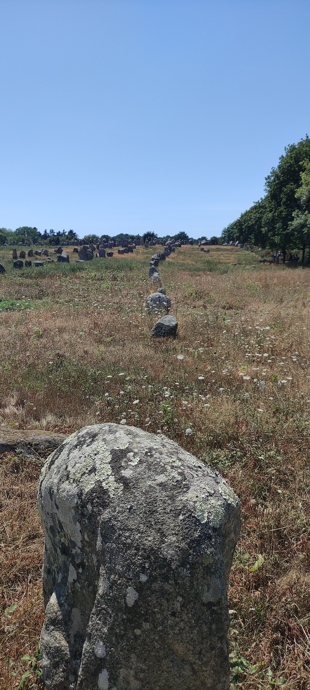
The megaliths are the south's answer, and they have just become world news. On July 12, 2025 UNESCO inscribed "The Megaliths of Carnac and the shores of Morbihan" — Brittany's first World Heritage site — covering more than 550 monuments across the southern Morbihan. The heart is Carnac: about 3,000 menhirs in rows running over 2.5 miles (4 km), the Ménec alignment alone holding 1,099 stones in 11 rows, raised between about 4500 and 2500 BC — older than Stonehenge, contemporary with the first pyramids. Walk the megalith trail between Ménec, Kermario and Kerlescan from the Maison des Mégalithes (the Centre des monuments nationaux manages the alignments; the paths around them are open and free year-round), and add Locmariaquer's Great Broken Menhir, 68 feet (20.6 m) of fallen granite that was once the largest standing stone in Europe.
Between those poles lies the coast itself. On the Côte de Granit Rose, the GR34 runs through Ploumanac'h — France's favorite village in 2015 — past chaos-piles of pink granite to the Mean Ruz lighthouse, the finest half-day walk in the north. Car-free Île de Bréhat, ten minutes by boat from Pointe de l'Arcouest, is the flower island of hydrangeas and two tides a day. In the south, the Gulf of Morbihan — Breton for "little sea" — is a drowned landscape of some 42 islands; boats from Vannes and Locmariaquer thread its fierce currents to Île aux Moines for a day of cycling between stone cottages. And if the trip bends west, finish at Finistère, "land's end": the Pointe du Raz staring at the Île de Sein, the lighthouse island of Ouessant (Ushant) with Créac'h, among the most powerful lights on earth, and the walled Ville Close of Concarneau afloat in its harbor.
Picture the place
At Ploumanac'h the granite is the color of crushed raspberries at evening, the path threading boulders the size of houses — one shaped like a whale, one like Napoleon's hat — and the lighthouse standing pinker still against a green sea.
The easily missed detail
Mont Saint-Michel, the abbey-island in the great bay to the east, is not in Brittany — the Couesnon river that forms the border shifted west of the Mount, which is why Bretons recite that "the Couesnon, in its madness, put the Mont in Normandy." It is a superb day trip from Saint-Malo (40 minutes) — just file it correctly: you will be visiting the neighbors, and Breton pride will thank you for knowing it.
A practical rhythm
- Tide before itinerary — In Saint-Malo, print the week's tide tables on arrival and build fort walks and beach time around low water
- Carnac from the Maison des Mégalithes — Walk Ménec to Kerlescan in the morning light, then the Prehistory Museum in Carnac town for the finds
- One island day — Bréhat from the north or Île aux Moines from the south; book the boat in season and take the first sailing
What could complicate the plan
Access to the Carnac enclosures themselves is managed for conservation — in high season the alignments are entered on guided visits, while the surrounding trail stays free year-round; the UNESCO inscription of 2025 will tighten, not loosen, protection. The Saint-Malo tidal walks are genuinely dangerous to misjudge — the sea returns faster than a walk, and local advice is to carry the tide times on your phone. Belle-Île, Houat and Ouessant ferries book out on summer weekends, and the west's weather closes boat trips to Sein and Ouessant in rough seas.
What to do next
Draw the arc: Saint-Malo and Dinan, then west to the granite coast, then south to Carnac and the Gulf — a week minimum, ten days at a Breton pace.
Sources
- UNESCO World Heritage Centre — The Megaliths of Carnac and the shores of Morbihan, inscribed July 12, 2025 (criteria i and iv); Brittany's first World Heritage site, with 550-plus monuments
- Centre des monuments nationaux — the Carnac alignments: about 3,000 menhirs over 4 km (Ménec: 1,099 stones in 11 rows), and the open megalith trail
- SHOM / EDF — the Saint-Malo bay tides reaching 13.5 m and the La Rance tidal power station (1966), 240 MW
- Comité Régional du Tourisme de Bretagne — Ploumanac'h, voted France's favorite village in 2015; the car-free Île de Bréhat