Kigali / Rwanda When to visit
When should I visit Kigali, Rwanda, for the best experience?
The short answer
June through August is Kigali's driest season, with July averaging just 0.55 inches (13.9 mm) of rain, compared with 6.36 inches (161.5 mm) in November.
The answer, with local context
Kigali lies in Rwanda's central highlands, where elevation keeps temperatures relatively moderate despite the city's location close to the equator. The Japan Meteorological Agency publishes climate normals for its Kigali station at 1,491 meters (4,892 feet) above sea level, at 1.97° south latitude and 30.13° east longitude.
Monthly mean temperatures change less than rainfall. June averages 71°F (21.5°C), July 71°F (21.7°C), and August 73°F (22.5°C). These figures represent averages across the entire day, rather than afternoon highs. For walking the city's hills and visiting its open-air spaces, the lower rainfall from June through August is a more significant seasonal advantage than a large change in temperature.
The wettest periods fall principally around March–May and October–November. March averages 5.20 inches (132.1 mm), April 4.81 inches (122.1 mm), and October 4.73 inches (120.2 mm). By contrast, June averages 0.85 inches (21.6 mm) and August 1.54 inches (39.2 mm). September forms a transition, averaging 2.46 inches (62.4 mm).
Kigali's attractions include memorial gardens, urban museums, and restored wetlands. At Nyandungu, the Rwanda Environment Management Authority reports the restoration of 121.7 hectares of degraded wetland, creating an ecological landscape within the capital's outskirts. The drier winter months are especially suitable for combining such outdoor spaces with visits to the city's historic institutions.
Picture the place
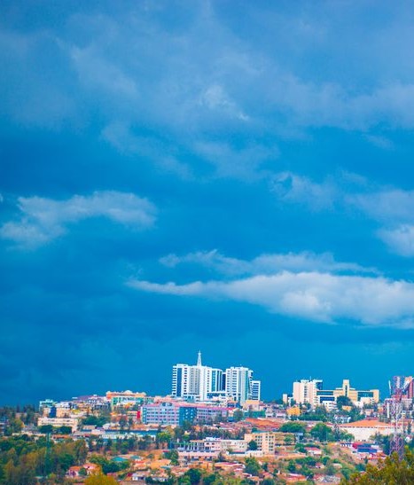
Kigali spreads across a series of hills and valleys. Roads climb between residential districts, commercial centers, and wooded slopes; the Nyandungu wetlands introduce ponds and vegetation into that otherwise urban landscape.
The easily missed detail
Kigali's driest month is July, but August's monthly mean temperature is slightly warmer: 73°F (22.5°C) versus July's 71°F (21.7°C). Travelers seeking the lowest historical rainfall should favor July, while those seeking a still-relatively-dry month with slightly warmer conditions can consider August.
A practical rhythm
Morning — Gisozi: Visit the Kigali Genocide Memorial, allocating at least 90 minutes for the exhibits and gardens.
Midday — City museum: Explore the Kandt House Museum's historical collections.
Afternoon — Nyandungu: Walk through the restored wetland landscape on an appropriate visitor route.
What could complicate the plan
Rwanda is currently under a Level 3: Reconsider Travel U.S. advisory, issued June 4, 2026, because of crime, health concerns, and unrest. The advisory also identifies areas within 10 kilometers of the Democratic Republic of the Congo border as Level 4. Kigali is not within that border restriction. During the wetter months, heavy rain can affect road journeys and steep pedestrian routes.
What to do next
provides the historical and natural attractions to prioritize. introduces Rwandan dishes and places to seek them within the capital.
Sources
- Japan Meteorological Agency, Kigali Climate Normals — station location, elevation, monthly temperatures, and rainfall.
- Rwanda Environment Management Authority, Nyandungu Urban Wetland Ecotourism — restoration area and ecological setting.
- Kigali Genocide Memorial, Visitor Information — visit duration and location.
- U.S. Department of State, Rwanda Travel Advisory — advisory level and regional restrictions.