Ladakh / India When to visit
When should I visit Ladakh, India, for the best experience?
The short answer
September — the high passes are all still open, the summer crowds and the monsoon-era surprises have thinned, Leh's days run a bright 74°F (23.5°C), and Ladakh's short autumn arrives with the clearest skies of the year.
The answer, with local context
Ladakh is a cold desert held shut by altitude and opened by two roads, so its calendar is written by the Border Roads Organisation as much as by the weather. Leh, the capital and every traveler's base, stands at 11,562 feet (3,524 m) in the rain shadow of the Greater Himalaya: the India Meteorological Department's normals give the town barely 4 inches (100 mm) of precipitation in a whole year — July, in the middle of India's monsoon, averages just 0.54 inches (13.8 mm) — and more than 300 sunny days. The IMD's Leh table sets the summer frame: July is the warmest month, with a mean high of 81°F (27.8°C) and nights at 59°F (15.1°C), while January inverts the world at a 35°F (1.9°C) high and an 8°F (−13.4°C) low. September keeps most of the warmth — a mean high of 74°F (23.5°C), a low of 48°F (9.1°C), and 0.35 inches (8.9 mm) of rain across fewer than three rainy days — while the crowds that pack June to August drain away.
Access decides the rest, and the Leh district administration publishes the seasons plainly: the Manali–Leh highway normally runs from May or June to September or October, and the Srinagar–Leh highway from May to November or December. Both are therefore reliably open through September, when the high passes — Khardung La to Nubra, Chang La to Pangong — are snow-free and the rivers they cross run low and clear. September is also harvest time: the apricot orchards of the lower valleys are picked by late summer, the barley comes in, and the poplars along the Indus begin their turn to gold. The great Hemis Festival, with its masked cham dances at Ladakh's largest monastery, belongs to June or July and is the one spectacle a September trip forfeits.
The alternatives are honest ones. June through August is the full summer — the festivals, the warmest nights for the lakeside camps at Pangong and Tso Moriri — at the price of the crowds and the prices. Winter is a different country altogether: Leh's January nights average 8°F (−13.4°C), both highways close, and the region belongs to the frozen-river Chadar season and the snow-leopard expeditions. One modern footnote rewrites the old map slightly: in the winter of 2025–26 the BRO kept the Zoji La pass on the Srinagar road open through the winter for the first time — but flights and luck remain the only sane winter plan.
Picture the place
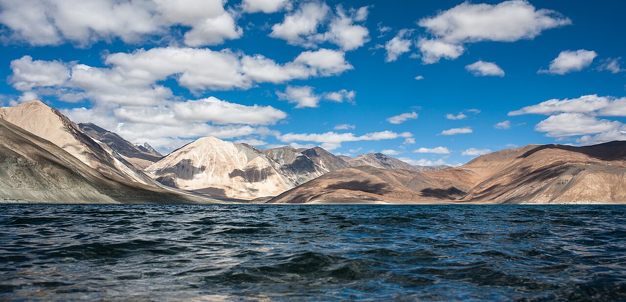
From the Shanti Stupa above Leh on a September evening the whole system is visible at once: the Indus running green-gray through a valley going gold with poplar and barley stubble, the Stok range catching the last light across the river, and not a wisp of cloud in a sky that has been washed all summer and finally stands empty.
The easily missed detail
The monsoon's irrelevance is the fact travelers most often get backwards: while the rest of India plans around July and August rain, those are statistically Ladakh's driest, warmest trekking months, with Leh receiving less rain in all of July than Mumbai gets in a single heavy afternoon. The weather risk in Ladakh is not the monsoon — it is altitude, cold and the calendar of the passes. Leh stands far above the 8,000-foot sleeping altitude at which unacclimatized travelers begin to risk altitude illness, whose symptoms usually appear 2 to 12 hours after arrival; the published guidance is 2 to 3 nights between 8,000 and 9,000 feet before climbing higher, no more than 1,650 feet of sleeping gain a night above 9,800 feet, and mild exercise with no alcohol for the first 48 hours — which is an argument for two slow days in Leh before any pass.
A practical rhythm
- Morning — September mornings are for the monasteries and the passes: Thiksey's dawn prayers in the cold first light, and any Khardung La or Chang La crossing begun early, before the altitude wind builds.
- Midday — Midday is the valley floor's hour: the Indus-side villages, Alchi's murals and the apricot lanes of the lower Sham valley, in the day's full warmth at 74°F (23.5°C).
- Evening — Evenings contract fast at altitude in September — Leh's dinner hour belongs to the old town's cafés and bakeries, and any night drive over a pass is a plan to unmake.
What could complicate the plan
The rain shadow is fraying at the edges: in August 2025 Leh recorded 80.2 mm of rain — more than five times the IMD's August normal of 15.4 mm and the highest August total in 52 years — bringing flash floods on the Srinagar road and a cloudburst in Kargil district. Build a buffer day into any road itinerary and treat a "highway open" report as a morning check, not a guarantee. Altitude is the second constant: Leh's 11,562 feet (3,524 m) demands a first day of rest whatever the month, and September's nights fall toward freezing at the lakes, which stand 2,300 feet higher still. Finally, the season's end is a cliff, not a slope — the Manali road's closure, which came in mid-November in 2025 and late October in other years, can strand an itinerary built on leaving by road in October.
What to do next
Book September, fly into Leh and give it two quiet days, then run the circuit — Indus monasteries, Nubra over Khardung La, Pangong over Chang La — while every road in the region is still open at once.
Sources
- India Meteorological Department — the Leh station normals for 2011–2024: July mean high 81°F (27.8°C) and low 59°F (15.1°C) with 0.54 inches (13.8 mm) of rain; September high 74°F (23.5°C), rain 0.35 inches (8.9 mm); January high 35°F (1.9°C) and low 8°F (−13.4°C); August 2025's exceptional 80.2 mm against a 15.4 mm normal
- District Leh administration, UT Ladakh — the published road seasons: Manali–Leh normally May/June to September/October; Srinagar–Leh May to November/December
- Border Roads Organisation (BRO) — the Manali–Leh highway's 2026 opening to civilian traffic on May 12, and Zoji La kept open through the winter of 2025–26 for the first time
- US Centers for Disease Control and Prevention, CDC Yellow Book 2026, High-Altitude Travel and Altitude Illness — risk from a sleeping altitude of about 2,450 m (8,000 ft), symptom onset 2 to 12 hours after arrival, 2 to 3 nights at 2,450–2,750 m before further ascent, no more than 500 m (1,650 ft) of sleeping gain per night above 3,000 m (9,800 ft), and mild exercise with limited alcohol for the first 48 hours