Langkawi / Malaysia Things to do
What are the most worthwhile things to do in Langkawi on a first visit?
The short answer
Ride the SkyCab up Gunung Machinchang and walk the Sky Bridge, boat the mangrove rivers of Kilim Karst Geoforest Park, and island-hop to Dayang Bunting's freshwater lake — the three experiences that explain why this whole archipelago is a UNESCO Global Geopark.
The answer, with local context
The frame for everything is geological. On June 1, 2007, UNESCO designated the entire Langkawi archipelago — all 99 islands, some 47,848 hectares — a Global Geopark, the 52nd in the world network and the first in Southeast Asia, for holding the best-exposed and most complete Palaeozoic sedimentary sequence in Malaysia, running unbroken from the Cambrian to the Permian. The geopark is organized into geoforest parks, and the first visit should touch each kind. On the northwest coast, the Machinchang Cambrian Geoforest Park protects the Machinchang Formation, Cambrian sandstone more than 550 million years old and the oldest rock unit in Malaysia, raised into a serrated range. The SkyCab cable car climbs it from the Oriental Village: a 1.34-mile (2.15 km) ride rising 2,230 feet (680 m), with a 42-degree gradient on its steepest section and a 3,117-foot (950 m) free span — the longest of any mono-cable gondola — between towers.
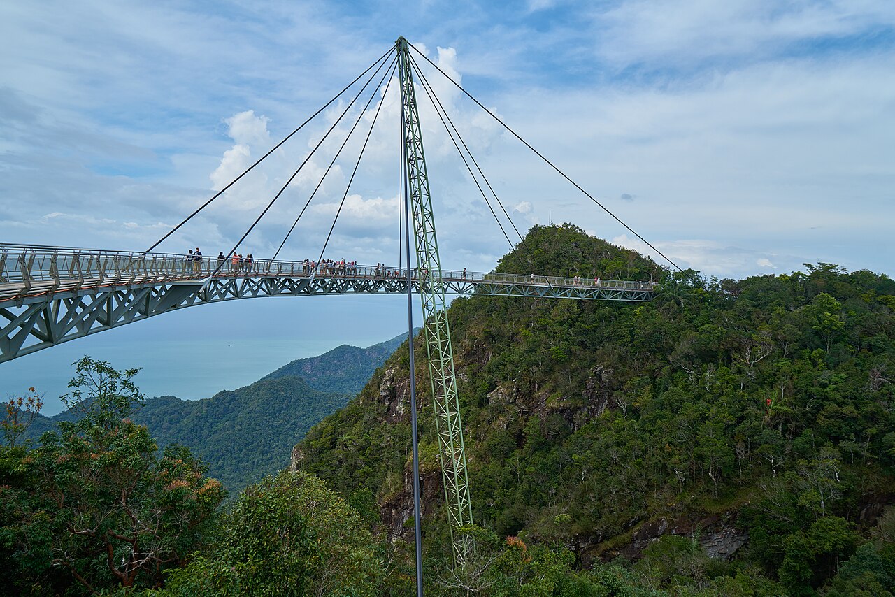
At the top station, 2,323 feet (708 m) up Gunung Machinchang, the Sky Bridge completes the experience: a curved pedestrian bridge 410 feet (125 m) long — the longest free-span curved bridge in the world — hung from a single 269-foot (82 m) pylon, its deck floating at 2,165 feet (660 m) above the forest with the Andaman and the Thai islands beyond. The east of the island answers with Kilim Karst Geoforest Park, 2,415 hectares where three rivers — Kilim, Air Hangat and Kisap — thread a maze of limestone pinnacles, mangrove forests and sea caves, including Gua Kelawar, the bat cave; boat tours here watch the brahminy kites and sea eagles that gave Langkawi its name, from helang, the brown eagle, and kawi, the reddish-brown stone. The third geoforest park lies offshore on Pulau Dayang Bunting, the archipelago's second-largest island, where Tasik Dayang Bunting — the Lake of the Pregnant Maiden — holds fresh water behind a thin limestone ridge only yards from the sea.
The human island deserves its hours too. Kuah, the main town, pairs the 39-foot (12 m) eagle statue of Dataran Lang, opened in 1996 on its waterfront square, with the duty-free shopping that has defined Langkawi since the federal government declared it a duty-free port on January 1, 1987 — the Langkawi Development Authority followed in 1990 to build the tourism island around that decision. At Padang Matsirat, the Mahsuri tomb complex tells the island's founding legend: the maiden executed on a false charge whose white blood proved her innocence and whose curse bound Langkawi for seven generations, in the same village whose granary was burned against the Siamese invasion of 1821 — Padang Matsirat means the field of burnt rice. And on a clear morning the drive up Gunung Raya, the island's highest peak at 2,890 feet (881 m), surveys the whole archipelago from the summit where Malaysia's MEASAT satellite control center has tracked the nation's satellites since 1996.
Picture the place
From the Sky Bridge the archipelago assembles itself: the ancient sandstone ridge falling away under your feet, rainforest running down to a coast scalloped with bays, and island after island standing in the blue — the same Palaeozoic rocks, worn into ninety-nine separate shapes by half a billion years of sea.
The easily missed detail
The Sky Bridge's curve is not decoration. The bridge arcs because its single pylon and cable system hold a curved deck more rigidly against the mountain winds than a straight span, and its glass floor panels look straight down through 2,165 feet (660 m) of air and canopy to the forest floor of the Machinchang range — the vertigo is engineered, deliberate, and the reason the bridge survived its 2012–2015 closure and rebuilding as a stronger structure.
A practical rhythm
- Morning — The SkyCab is a morning appointment: take the first gondolas up Machinchang before the queues and the afternoon cloud, and walk the Sky Bridge while the islands are still outlined in clear air.
- Midday — Midday is for the water-level island: a Kilim river boat through the mangroves at the heat of the day, when the caves and channels are shaded and the eagles ride the thermals.
- Evening — Evenings belong to Kuah: the eagle at Dataran Lang at sunset, duty-free chocolate and kitchenware in the malls, and dinner in the town where Langkawi's own people eat.
What could complicate the plan
The SkyCab stops for wind and maintenance without apology — high winds close it even on sunny days, and its periodic maintenance weeks are published in advance, so build the Machinchang day with a swap in hand. Pulau Payar, the marine park whose reef is the area's best snorkeling, lies an hour by boat to the south and its trips are the first cancelled when the sea rises; in the wet months the crossing can be rough even when it runs. Finally, the geopark is an archipelago, not a park with gates: the distances between Machinchang in the northwest, Kilim in the east and Kuah in the southeast are 30 to 45 minutes by road, so a rental car or a planned driver is the difference between seeing the island and commuting across it.
What to do next
Give the first visit three anchors: a clear morning for Machinchang and the Sky Bridge, a boat day split between Kilim's rivers and Dayang Bunting's lake, and an evening in Kuah for the eagle, the duty-free halls and the Mahsuri story at Padang Matsirat on the way.
Sources
- UNESCO Global Geoparks / Langkawi UNESCO Global Geopark — the June 1, 2007 designation, first in Southeast Asia and 52nd worldwide; the archipelago-wide 47,848-hectare geopark and its Machinchang, Kilim and Dayang Bunting geoforest parks; the Palaeozoic sequence from Cambrian to Permian
- Panorama Langkawi (SkyCab operator) — the cable car's 42-degree steepest gradient, 3,117-foot (950 m) free span and 2,230-foot (680 m) climb; the Sky Bridge's 410-foot (125 m) curved span, single 269-foot (82 m) pylon and 2,165-foot (660 m) elevation
- Langkawi Development Authority (LADA) — duty-free status from January 1, 1987 and the authority's establishment in 1990; Dataran Lang and the Kuah waterfront
- Department of Fisheries Malaysia — Pulau Payar Marine Park, protected since 1994