Madagascar country guide Places and experiences
What should a first-time traveler see in Madagascar beyond the obvious highlights?
The short answer
Explore the eastern rainforest around Andasibe, the limestone landscapes of the Andrefana Dry Forests, and the Royal Hill of Ambohimanga to encounter Madagascar's endemic wildlife, unusual geology, and royal heritage.
The answer, with local context
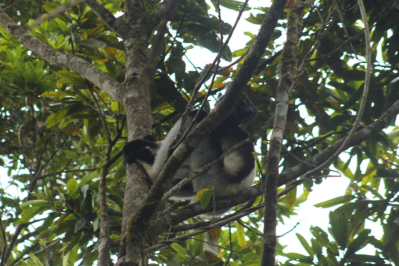
Madagascar's eastern rainforests support species found nowhere else. Near Andasibe, the forests are particularly associated with the indri, the largest living lemur. Mantadia National Park lies in this eastern rainforest region and covers 15,480 hectares, according to Madagascar National Parks. Its official visitor information identifies hiking and guided wildlife observation among available activities and recommends the May–October dry season for generally easier forest exploration.
Farther west, a completely different natural environment appears in the Andrefana Dry Forests. UNESCO originally inscribed the Tsingy de Bemaraha property in 1990 and expanded it in 2023 into the present serial World Heritage property. The expanded designation includes four national parks—Ankarafantsika, Mikea, Tsingy de Bemaraha, and Tsimanampesotse—and two special reserves, Analamerana and Ankarana.
The protected landscapes range from western dry forests to southwestern thorny thickets. Tsingy de Bemaraha is particularly famous for its sharply eroded limestone formations, which rise into an intricate landscape of natural towers, fissures, and canyons. UNESCO also identifies the Manambolo River canyon, mangroves, lakes, and habitats for endangered lemurs and birds among the property's features.
Madagascar's second natural World Heritage property, the Rainforests of the Atsinanana, was inscribed in 2007 under criteria (ix) and (x). Its six national-park components cover approximately 479,661 hectares along the island's eastern forest belt. UNESCO placed the property on the List of World Heritage in Danger in 2010 but removed it in 2025 following a conservation review. Forest clearing, mining, and hunting remain documented concerns.
The cultural counterpoint is the Royal Hill of Ambohimanga, north of Antananarivo. UNESCO inscribed it in 2001, under criteria (iii), (iv), and (vi). The site preserves royal buildings, sacred places, burial areas, and a traditional cultural landscape associated with the Merina monarchy.
Picture the place
Madagascar's landscapes change dramatically between destinations. Eastern forest trails pass beneath dense tropical vegetation; the western tsingy form jagged pale limestone ridges; Ambohimanga occupies a wooded hill associated with fortified royal architecture.
The easily missed detail
The UNESCO designation Andrefana Dry Forests is a serial property, not a single park with one entrance. Its six component protected areas occupy different parts of western and southwestern Madagascar. Visiting Ankarana in the north is geographically and logistically different from visiting Tsingy de Bemaraha farther west.
A practical rhythm
Eastern rainforest — Andasibe: Explore an accessible forest area with a guide and look for indri and other endemic wildlife.
Royal heritage — Ambohimanga: Visit the historic hill from an Antananarivo-area base.
Western wilderness — Andrefana: Select one suitable protected-area component for a separately planned excursion.
What could complicate the plan
The western limestone protected areas can involve difficult roads, steep paths, and specialized access arrangements. Madagascar National Parks states that Mantadia requires a suitable field vehicle, with an approach from National Road 2 near Andasibe. The State Department warns that some rural routes present significant crime risks and that medical infrastructure is extremely limited outside populated areas. A technically demanding tsingy excursion should not be substituted for a straightforward forest walk in a family itinerary.
What to do next
explains how to select a limited number of regions for a first trip. provides the seasonal context for adding the Avenue of the Baobabs on the western side of the island.
Sources
- Madagascar National Parks, Mantadia — park area, wildlife, hiking, access, and recommended season.
- UNESCO World Heritage Centre, Andrefana Dry Forests — inscription history, six protected-area components, ecosystems, and geology.
- UNESCO World Heritage Centre, Rainforests of the Atsinanana — 2007 inscription, area, and conservation history.
- UNESCO World Heritage Committee, Decision 47 COM 8C.2 — removal of the Rainforests of the Atsinanana from the Danger List in 2025.
- UNESCO World Heritage Centre, Royal Hill of Ambohimanga — cultural inscription and royal landscape.
- U.S. Department of State, Madagascar Travel Advisory — travel-access and remote-area safety concerns.