Madagascar country guide When to visit
When is the best time to visit Madagascar for Avenue of the Baobabs?
The short answer
May through October is the strongest period for a Madagascar trip centered on the Avenue of the Baobabs, combining the western region's drier season with cooler average temperatures around Morondava.
The answer, with local context
Madagascar's seasons vary considerably between its coastal regions, central highlands, and western dry forests. The island generally experiences a wetter summer from November through April and a drier winter from May through October. The eastern rainforests remain much wetter than the west, while highland destinations such as Antananarivo experience cooler nights because of their elevation. Travelers combining several parts of Madagascar should therefore avoid treating the island as one climate zone.
The Avenue of the Baobabs lies in the Morondava District of the Menabe Region, on Madagascar's western side. The Japan Meteorological Agency's Morondava station is located at 20.28° south, 44.32° east, just 23 feet (7 meters) above sea level. Its published monthly normals show a mean temperature of 77°F (24.9°C) in May, 73°F (23°C) in June, 73°F (22.6°C) in July, and 74°F (23.2°C) in August.
Temperatures rise toward the wetter months. Morondava's monthly mean reaches 79°F (26.3°C) in October, 83°F (28.1°C) in November, and approximately 83°F (28.6°C) in both December and January. These are full-day means, not daytime highs. The available station table does not publish monthly precipitation normals, so the seasonal recommendation relies on Madagascar's documented west-coast climate pattern rather than an unsupported rainfall figure.
The avenue is more than a roadside photographic landmark. Decree No. 2015-760 of 28 April 2015, published on Madagascar's national legislation portal, creates the protected area named Allée des Baobabs in the Bemanonga rural commune of Morondava District, and its annexes record a dry-forest core zone at Bekonazy Centre of 1.68 hectares. FANAMBY, the conservation organization that manages the site, states that this definitive protected status came as part of a wider group of areas established in 2015.
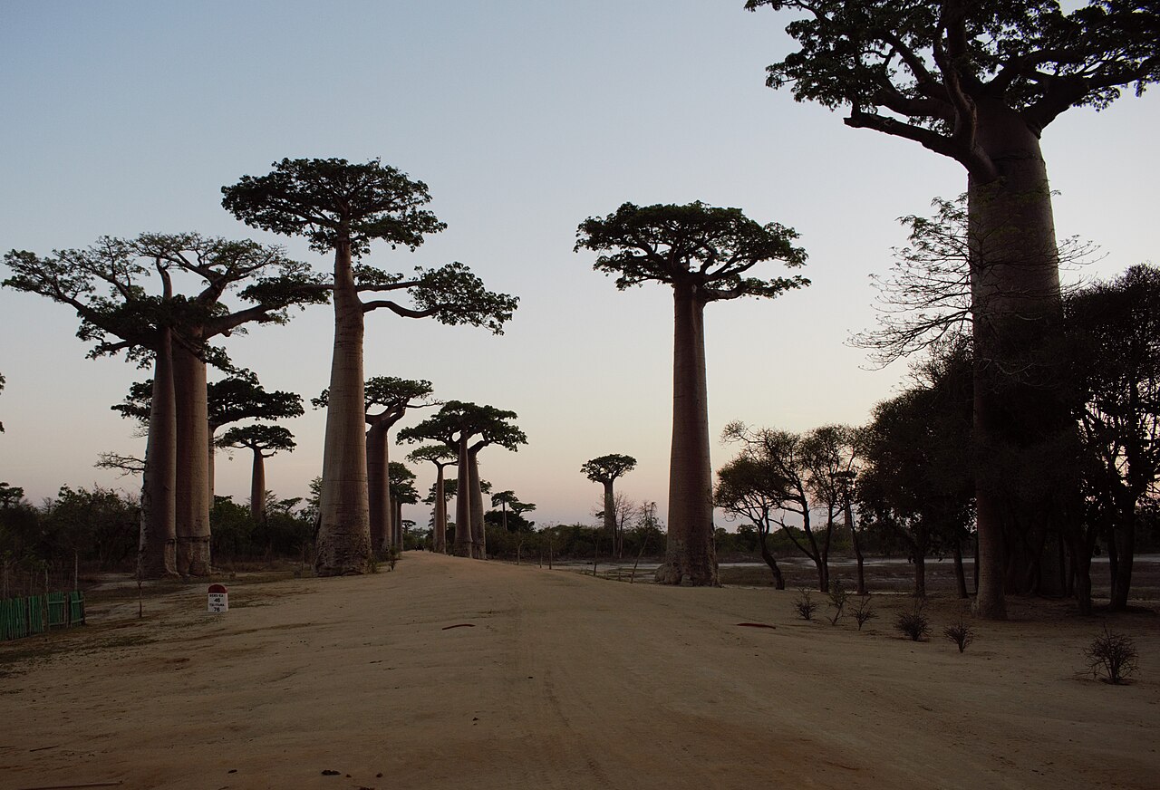
The avenue's best-known trees are Adansonia grandidieri, one of Madagascar's endemic baobab species. Their tall trunks and relatively compact crowns create the distinctive roadside arrangement. The setting is a living landscape used by nearby communities, not an archaeological monument or a botanical garden.
Picture the place
Massive cylindrical baobab trunks rise beside a red-earth road. The trees stand above surrounding low vegetation, making their height and unusual silhouettes particularly visible against the open sky.
The easily missed detail
The Avenue of the Baobabs is a protected area created by Malagasy decree, not a UNESCO World Heritage Site. Madagascar has three UNESCO World Heritage properties: the Royal Hill of Ambohimanga, Andrefana Dry Forests, and the Rainforests of the Atsinanana. The avenue has its own protected-area designation, boundaries, and conservation management.
A practical rhythm
First day — Morondava: Arrive and establish a base before beginning rural excursions.
Second morning — Avenue of the Baobabs: Explore the protected roadside landscape with a locally arranged transfer.
Late afternoon — Return visit: Photograph the trees in lower-angle light, then return to Morondava without planning an unnecessary long nighttime road journey.
What could complicate the plan
The U.S. State Department's Level 2 advisory issued December 5, 2025 identifies elevated crime risks on roads in western Madagascar. It specifically warns about the Menabe Region south of Morondava and the RN34 section between Miandrivazo and Malaimbandy. Those restrictions should not be automatically applied to every location in Menabe, but they are important when selecting an overland approach. Rainy-season road damage, limited rural medical services, and the protected monument's conservation rules are additional considerations.
What to do next
explores Madagascar's other protected landscapes, while explains how to fit Morondava into a wider itinerary without attempting an unrealistic number of overland transfers.
Sources
- Japan Meteorological Agency, Morondava Monthly Climate Normals — monthly mean temperatures, coordinates, and station elevation.
- Government of Madagascar, national legislation portal — Decree No. 2015-760 of 28 April 2015 creating the Allée des Baobabs protected area, with its commune, district and the Bekonazy Centre core zone.
- FANAMBY, Organizational History — 2015 definitive protection and conservation management.
- UNESCO World Heritage Centre, Madagascar — distinction between the avenue and Madagascar's inscribed properties.
- U.S. Department of State, Madagascar Travel Advisory — advisory date, restricted road corridors, and regional security conditions.