Peru country guide Trip planning
How can I plan a memorable first trip to Peru without rushing?
The short answer
Give Peru a minimum of two weeks and a single direction: land in Lima, arc south through Arequipa and Lake Titicaca to Cusco and Machu Picchu, and let the Amazon be a deliberate coda from Cusco — never a commute between all of them.
The answer, with local context
The case for slowness is written in the country's dimensions. Peru covers 496,225 square miles (1,285,216 km²) — the third-largest country in South America — and its three stripes hold their populations inversely: the coast packs over half of all Peruvians onto 11.6% of the land, while the Amazon's 60.3% of the territory holds a small minority, in towns measured in river hours. Distances obey mountains, not maps. Lima to Cusco is 363 miles (584 km) by air and 684 miles (1,100 km) by road: the flight takes about 1 hour 20 minutes; the bus takes 18 to 23 hours over passes above 15,748 feet (4,800 m). Cusco to Puno, on Lake Titicaca, is 242 miles (390 km) and 6 to 7 hours by road — or the daylight train, which crosses the La Raya pass at 14,177 feet (4,321 m), the highest point of the run. Cusco to Puerto Maldonado, the southern Amazon gateway, is 45 minutes by air against 8 to 10 hours of mountain road. And Iquitos, the northern Amazon's capital of some 500,000 people, has no road at all: it is the largest city in the world unreachable by road, entered by a 2-hour flight from Lima or days of river.
The unhurried shape follows from those numbers. Two nights in Lima to land, eat and see the historic center; fly south to Arequipa for two or three, letting its 7,661 feet (2,335 m) work as the altitude staircase's first step before Colca; continue to Puno for the lake, then ride the train or the Sun Route bus up to Cusco — arriving there with altitude already half-earned. Give the Cusco region the trip's center of gravity: five or six nights split between the Sacred Valley's lower 9,000-foot elevations and the city, with Machu Picchu as a day (or two) inside that block rather than a dash from the airport. Then, if the Amazon calls, fly Cusco–Puerto Maldonado for three nights in Tambopata or commit properly to Manu's multi-day expedition — and fly out through Lima with a night to spare.
The discipline is what you refuse: the north — Trujillo, Chan Chan, Kuélap, Caral — is a second trip, not a detour, and the classic failure is counting destinations instead of nights, arriving at the citadel on day three with altitude sickness and a return flight on day five.
Picture the place
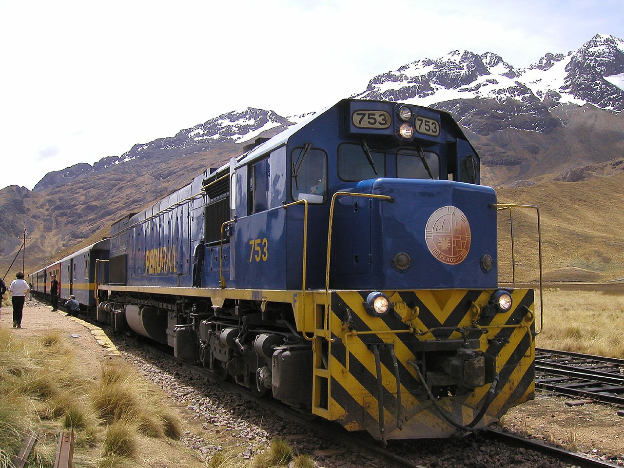
On the Cusco–Puno line the train slows to walking pace at La Raya, 14,177 feet (4,321 m) up, where vendors in layered skirts sell sweaters and coca tea beside the rails and the altiplano runs gold and empty to a horizon of snow peaks — the whole logic of Peruvian geography, visible from one window: altitude first, distance second, hurry nowhere.
The easily missed detail
Sleep low to see the high place: Machu Picchu, at 7,972 feet (2,430 m), stands more than 3,000 feet below Cusco's 11,152 feet (3,399 m) — so the kind sequence for lungs and legs is to descend into the Sacred Valley on arrival and save Cusco city for the return, a routing that costs nothing and rescues more first trips than any medicine. The citadel is the low point of its own excursion; the capital of the Inca is the altitude problem.
A practical rhythm
- Morning — Mornings are for altitude's kindness: schedule the passes, the high lookouts and the citadel's first entry slots early, when the air is clear and the body is freshest, and let travel days begin after breakfast rather than before dawn.
- Midday — Midday is when Peru moves you: the daylight trains and the Sun Route buses cross the altiplano in the photogenic hours, and the domestic flights — Lima–Cusco runs dozens of times a day — turn what would be a lost night into an afternoon in a new city.
- Evening — Evenings are for staying put: the unhurried trip is measured in two- and three-night stands, so each town gets its dusk — Arequipa's sillar glowing, a Puno lakeside dinner, a Cusco plaza night — instead of a blur of bus stations.
What could complicate the plan
Altitude punishes compression above all: flying Lima–Cusco and touring the same day is the classic itinerary error, and the schedule needs a genuine buffer before any Inca Trail start. The wet season (November–April) inserts its own delays on mountain roads and closes the Trail in February; the El Niño watch on the northern coast, active through 2026 with effects forecast into early 2027, argues against bolting a beach week onto a first trip in that window. Finally, the system's crown jewels are capacity-controlled — Machu Picchu's named daily tickets and the Inca Trail's permits sell out months ahead in the dry season, so "without rushing" begins with booking early, not with traveling slowly.
What to do next
Draw the southern arc on one page — Lima, Arequipa, Puno, the Valley, Cusco, the jungle if time allows — put a minimum of two nights in every box, and let the north wait for the second trip it deserves.
Sources
- Instituto Nacional de Estadística e Informática (INEI) / national geography references — Peru's 496,225 square miles (1,285,216 km²), third-largest in South America; the coast's 11.6% of territory holding over half the population against the Amazon's 60.3%
- Domestic transport references — Lima–Cusco: 1 hour 20 minutes by air against 18–23 hours by road (684 miles / 1,100 km, passes above 15,748 feet / 4,800 m); Cusco–Puno 242 miles (390 km); Cusco–Puerto Maldonado 45 minutes by air; Lima–Iquitos 2 hours, with Iquitos the world's largest city without road access
- PeruRail — the Cusco–Puno route crossing La Raya pass at 14,177 feet (4,321 m), the highest point of the journey